|
The Earthquake, Fires, and Breakdown of Order
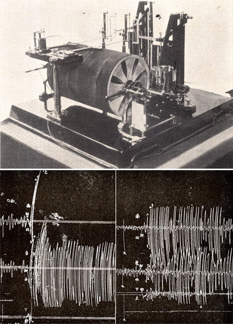
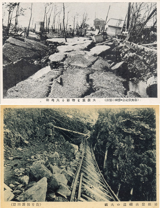
On 1 September 1923 Tokyo’s vulnerabilities were exposed unambiguously. At two minutes to noon a magnitude approximate 7.9 earthquake toppled structures, crushed people, and unsettled everyone who survived. Minutes later, another intense seismic wave battered eastern Japan. This earthquake killed scores more and triggered widespread panic across the capital. Over the next three days, survivors experienced nearly 2000 aftershocks and a series of hellacious conflagrations that unleashed widespread pandemonium, killed tens of thousands, and burned large swaths of Tokyo and Yokohama. The sights and smells of death and the cries of seriously wounded, half dead survivors amid this vanquished landscape led one anonymous chronicler to ask: “if this were not Hell, where would Hell be?” Tokyo had become a hell on earth.
Seismic Vulnerability and Upheaval
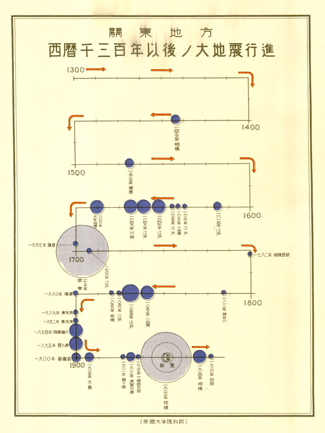 The Kantō region, which includes the population centers of Tokyo, Yokohama, and Kawasaki, is one of the most seismically vulnerable places on our planet. Deep below the waters of the Pacific Ocean roughly 275 km east of Tokyo and running north along Japan’s East Coast, the Pacific tectonic plate subducts beneath the North American-Okhotsk tectonic plate. Earthquakes along the boundary have rattled the eastern coast of Japan from Hokkaidō in the north, southward to the island of Iwo Jima since well before human history. Subduction along this plate triggered one of Japan’s largest earthquakes, the magnitude 9.0 Tōhoku Earthquake of 11 March 2011. The Kantō region, which includes the population centers of Tokyo, Yokohama, and Kawasaki, is one of the most seismically vulnerable places on our planet. Deep below the waters of the Pacific Ocean roughly 275 km east of Tokyo and running north along Japan’s East Coast, the Pacific tectonic plate subducts beneath the North American-Okhotsk tectonic plate. Earthquakes along the boundary have rattled the eastern coast of Japan from Hokkaidō in the north, southward to the island of Iwo Jima since well before human history. Subduction along this plate triggered one of Japan’s largest earthquakes, the magnitude 9.0 Tōhoku Earthquake of 11 March 2011.
 The population centers of eastern Japan are also vulnerable to the movements of two other tectonic plates that have triggered catastrophic earthquakes: the Philippine Sea tectonic plate and the Eurasian tectonic plate. The subduction zone created by the intersection of these two plates sits roughly 100 km south of Tokyo virtually bisecting Sagami Bay. Movements associated with these two tectonic plates triggered the 8.2 magnitude approximate Genroku Earthquake of 1703 and the 7.9 magnitude approximate Great Kantō Earthquake of 1923. Recent scholarship suggests that Tokyo is vulnerable to earthquakes triggered by the movement of yet another tectonic plate or “dislodged plate fragment” located directly beneath the Kantō Plain upon which Tokyo and approximately 33 million people reside today. The population centers of eastern Japan are also vulnerable to the movements of two other tectonic plates that have triggered catastrophic earthquakes: the Philippine Sea tectonic plate and the Eurasian tectonic plate. The subduction zone created by the intersection of these two plates sits roughly 100 km south of Tokyo virtually bisecting Sagami Bay. Movements associated with these two tectonic plates triggered the 8.2 magnitude approximate Genroku Earthquake of 1703 and the 7.9 magnitude approximate Great Kantō Earthquake of 1923. Recent scholarship suggests that Tokyo is vulnerable to earthquakes triggered by the movement of yet another tectonic plate or “dislodged plate fragment” located directly beneath the Kantō Plain upon which Tokyo and approximately 33 million people reside today.
 
Conflagration
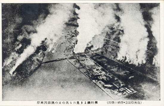
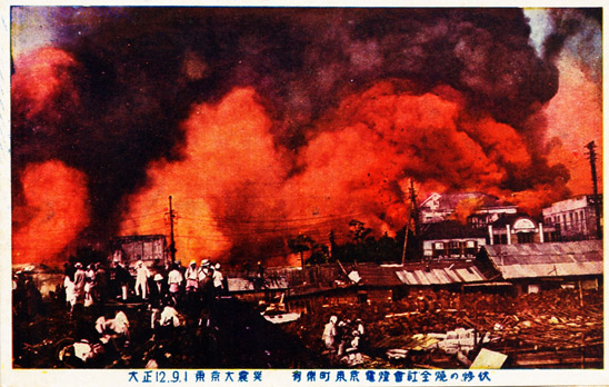
 As destructive and dislocating as the earthquake and aftershocks were to people of eastern Japan in 1923, a far more deadly phenomenon erupted shortly after the initial seismic upheaval: fire. Within 30 minutes of the first tremor more than 130 major fires broke out across Tokyo alone. Many were clustered in the densely populated and highly vulnerable eastern sections of the city including Asakusa, Kanda, Nihonbashi, Kyōbashi, Honjo, Fukagawa, Shitaya and the Ginza district in central Tokyo. As destructive and dislocating as the earthquake and aftershocks were to people of eastern Japan in 1923, a far more deadly phenomenon erupted shortly after the initial seismic upheaval: fire. Within 30 minutes of the first tremor more than 130 major fires broke out across Tokyo alone. Many were clustered in the densely populated and highly vulnerable eastern sections of the city including Asakusa, Kanda, Nihonbashi, Kyōbashi, Honjo, Fukagawa, Shitaya and the Ginza district in central Tokyo.
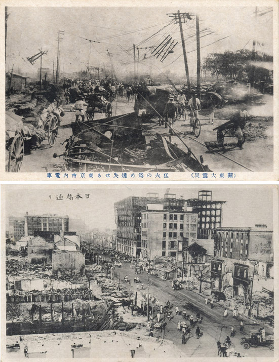 More dramatically, five independent whirlwind firestorms erupted across Tokyo and burned everything in their path. One individual who witnessed an approaching firestorm, Koizumi Tomi, described it as “an enormous wall of fire . . . like a tidal wave as if released from Hell itself” which “turned the air as hot as melting rock.” Another individual, Kawatake Shigetoshi, who narrowly escaped death as he fled fires from Honjo Ward relayed what he witnessed from a large field in Etchūjima, south of Fukagawa Ward: Tokyo was an inferno. He wrote: “We often use the expression ‘Take the story with a grain of salt.’ But in this case, the story should not be taken with a grain of salt. On the contrary, this story was too horrible to be exaggerated enough.” Put simply, he declared that Tokyo resembled what could only be described as a “burning Hell.” Other observers concurred with these depictions. Reporters for the Kyūshū nippō, a newspaper published in the southern island of Kyūshū suggested that Japan’s once great capital had been transformed into a “sea of fire” [zenshi hi no umi]. More dramatically, five independent whirlwind firestorms erupted across Tokyo and burned everything in their path. One individual who witnessed an approaching firestorm, Koizumi Tomi, described it as “an enormous wall of fire . . . like a tidal wave as if released from Hell itself” which “turned the air as hot as melting rock.” Another individual, Kawatake Shigetoshi, who narrowly escaped death as he fled fires from Honjo Ward relayed what he witnessed from a large field in Etchūjima, south of Fukagawa Ward: Tokyo was an inferno. He wrote: “We often use the expression ‘Take the story with a grain of salt.’ But in this case, the story should not be taken with a grain of salt. On the contrary, this story was too horrible to be exaggerated enough.” Put simply, he declared that Tokyo resembled what could only be described as a “burning Hell.” Other observers concurred with these depictions. Reporters for the Kyūshū nippō, a newspaper published in the southern island of Kyūshū suggested that Japan’s once great capital had been transformed into a “sea of fire” [zenshi hi no umi].
Panic and Confusion on the Streets of Tokyo

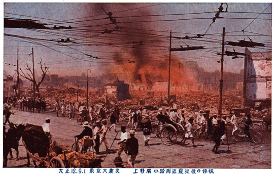
Within hours of the first seismic upheaval hundreds of thousands of people attempted to flee burning Tokyo. Streets, alleyways, bridges, rivers, canals, and open spaces became virtually impossible to navigate in the face of catastrophe. Kawatake Shigetoshi reflected how he found himself trapped in a mass exodus of people attempting to leave the city. “No matter how hard I tried,” he wrote, “I could not move in the direction I wanted to go.” He concluded: “I was stuck in a wave of people that acted like a single panicked entity.”
While many residents eventually escaped, tens of thousands did not. Some drowned in the Sumida River that snakes through Tokyo after jumping from crowded riverbanks or burning bridges to escape approaching fires. Others burned to death in streets, alleyways, parks, and in the few open spaces that existed in Tokyo. Of the roughly 120,000 people who perished, a majority died as a result of fire. At the 6.7 hectare site of what was once a large production and storage facility operated by the Clothing Department of the Imperial Japanese Army, referred to in 1923 as the site of the Honjo Clothing Depot [Hifukushō ato], over 35,000 peopled burned to death as a result of a whirlwind firestorm that enveloped that area on the night of 1-2 September.
The areas that once comprised Tokyo and Yokohama had become defined by death, destruction, and upheaval. However deadly and confronting the earthquake calamity had been, the hardest tasks for government officials and for the citizens of eastern Japan—restoration of order, relief, and recovery—was about to begin. It would prove to be an undertaking of enormous magnitude.
Sources in English
J. Charles Schencking. The Great Kantō Earthquake and the Chimera of National Reconstruction in Japan. New York: Columbia University Press, 2013. Chapter 1. Cataclysm: The Earthquake Disaster as a Lived and Reported Experience.
|